 |
China GPS Watch (Location Finder / Data Logger / Photo Tagger Manufacturer,Promotional Custom Imprinted GPS Watch (Location Finder / Data Logger / Photo Tagger,Advertising GPS Watch (Location Finder / Data Logger / Photo Tagger,discount GPS Watch (Location Finder / Data Logger / Photo Tagger supplies |
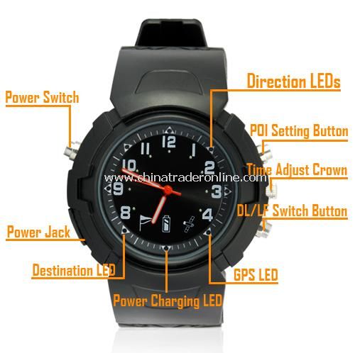

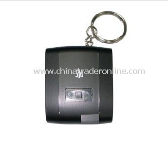
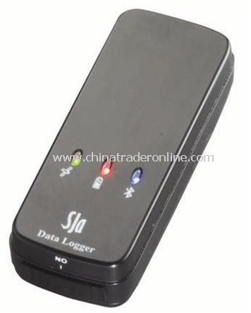
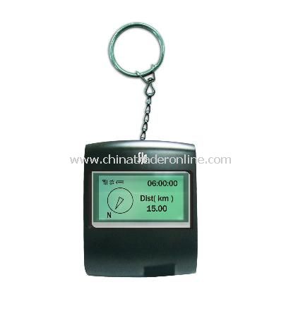
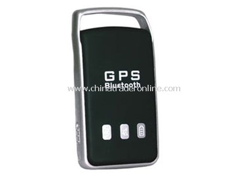
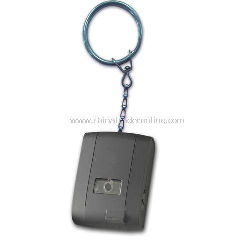
Product Name: GPS Watch (Location Finder / Data Logger / Photo Tagger
Model No.:CTO32253
U.Price: Negotiable
Price Terms: FOB
Payment Terms:T/T
Delivery Lead Time: Negotiable
Product Origin: China

Detailed Product Description
Place of Origin Guangdong, China
Type Gps Receiver
Use Hand Held
Function GPS Location,Logger,Navination,Watch
Memory 8M
Working time 21 hours
Position 5m 2D RMS (without SA)
Weight 66.8g
SBAS Support WAAS / EGNOS
Protocol NMEA-0183 V3.01; SkyTraq Binary
Certificate CE / FCC/ RoHS
Channels 65
Cold/Warm/Hot start 29/25/1 sec. (average)
Direction Guide to Place where you have been or never been
Memory travel Path and show directly on google map
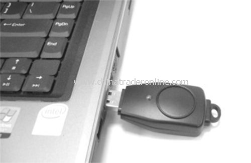
Working with notebook as gps navigator
Tagger photo to your map and save on your computer
Upload photo to online map via flickr
Display current time by 12 hour o'Clock
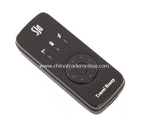
Travel Honey Watch (Location Finder+ Data Logger + Photo Tagger
| Main Features: |
| GPS chipset: Adopt SkyTraq Venus 6 chipset with 65-Channel for fast acquisition and reacquisition High sensitivity (to -160dBm) Excellent performance - Cold/Warm/Hot start time: 29/25/1 sec. (average) Support standard NMEA0183 WAAS / EGNOS supported Hardware: Capable of keeping up to 100,000 records or positions, including longitude, latitude, speed,UTC and tag data Smart power saving / 21 hours usage Eight LEDs indicate clear directions No installation needed, user friendly Slick Design, Portable Able to record POI (Place Of Interest) Two segment switch for two switch modes,Location Finder and Data Logger mode Software: Location searching engine Support Windows, XP, and Vista User friendly interface Able to upload to Flickr and Flickr Maps Add photos, videos, audio files, comments, and place names to any point on your track Write GPS info into photos Photo slide show Shift photo date and time Able to export your paths to KMZ, NMEA183, and GPX format to share your trips with your family and friends Easy track editing Incoming feature: support Video playback (AVI, MP4) View in Google Maps or Google Earth View multiple paths simultaneously Adjust color and width of tracks Display speed and altitude graphed against time View speed,alitutde,and GPS coordinates at any point on your path Display distance in metric or imperial units Display GPS coordinates in Degrees or Degrees, Minutes, Seconds Configure GPS device to log by intervals of time (every 5 sec., every 10 sec., etc.), distance (every 5 meters, 10 meters, etc.) or speed (over 8 km/hr, over 25 km/hr, etc.). Can be configured to log when one condition is met (e.g. create a log every 3 seconds) or only when multiple conditions are met (e.g. create a log every 10 meters when speed is greater than 60 km/hr). No fees/subscriptions:Free uPDAte,Included software is free and requires no subscription for any of the above functions Languages: English, Spanish, French, German, Dutch, Italian, Portuguese, Russian, Thai, Korean, Japanese, Simplified Chinese, Traditional Chinese Compatibility: Windows XP and Vista |
| Technical Specification: |
| Manufacturer reference No. | 12021 |
| Chipset | Skytraq Venus 6 | |
| Frequency | L1,1575.42 MHz | |
| C/A Code | 1.023MHz chip rate | |
| Channels | 65 all-in-view tracking | |
| Tracking Sensitivity | -160 dBm | |
| Accuracy | Position Horizontal | 10m 2D RMS (without SA) |
| WAAS enabled | 5m 2D RMS (without SA) | |
| Time | 1 micro-second synchronized to GPS time | |
| Velocity | 0.1 micro-second synchronized to GPS time | |
| Datum | WGS-84 | |
| Acquisition Rate | Hot Start | 1 sec.,average |
| Warm Start | 25 sec.,average | |
| Cold Start | 29 sec.,average | |
| Reacquisition | < 4 seconds fix with A-GPS support (Option) | |
| < 1s,.average(with power save mode OFF ) | ||
| Protocol | GPS Output data | NMEA-0183 V3.01 |
| Dynamic Condition | Acceleration | Less than 4G |
| Altitude | 18,000 meters max | |
| Velocity | 515 meters/sec. max. | |
| Power | Voltage | DC 5V + - 10% |
| Micro | Rechargeable 800 mAh Li-ion battery | |
| Operation hours | 21 hours continuous usage | |
| Temperature | Operating | -20+60 |
| Storage | -20+80 | |
| Humidity | Up to 95% non-condensing | |
| GPS Logger | Memory | Log 100,000 records in flash memory ( 8M bits) |
| Log data | Longitude,Latitude,Speed,UTC | |
| Output data format | KMZ, NMEA183, and GPX format | |
| Watch | time display | 12 hour o’clock |
| movement | Japanese SEIKO movement | |
| anti-water | 5ATM | |
| Color | Black and White available | |
| Weight | 66.8g (included battery) | |
| Certification | CE / FCC/ RoHS | |
| Accessories: |
| 1 x CD with iTravel Photo Tagger software and Driver 1 x Travel Charger 1 x USB Cable 1 x User Manual - English |
You may also be interested
Send Enquiry

Service |Infringe Claims Complain | Search Index | sitemap | wholesale suppliers |Products Index:A B C D E F G H I J K L M N O P Q R S T U V W X Y Z
Wholesale China GPS Watch (Location Finder / Data Logger / Photo Tagger Exporters,GPS Watch (Location Finder / Data Logger / Photo Tagger Factories, GPS Watch (Location Finder / Data Logger / Photo Tagger Distributor, Custom Logo Printing for Promotional Gifts
Wholesale China GPS Watch (Location Finder / Data Logger / Photo Tagger Exporters,GPS Watch (Location Finder / Data Logger / Photo Tagger Factories, GPS Watch (Location Finder / Data Logger / Photo Tagger Distributor, Custom Logo Printing for Promotional Gifts